

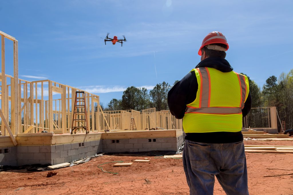
A drone surveyor is an individual who possesses a unique set of skills and knowledge in both surveying techniques and drone operations. They are experts in utilizing drones to capture aerial imagery, videos, and data that are critical for various industries such as construction, land surveying, agriculture, and more.
By using these unmanned aerial vehicles, drone surveyors can access remote or hazardous areas, cover vast territories efficiently, and collect geospatial data with unprecedented accuracy and speed.
Drone surveyors play a vital role in modern surveying practices, revolutionizing the way data is collected and analyzed. They are responsible for planning and executing survey missions, ensuring compliance with regulations and safety protocols, and leveraging advanced software tools to process and interpret the collected data. Their work provides invaluable insights for decision-making processes, enabling clients and stakeholders to make informed choices based on reliable and up-to-date geospatial information.
The path to becoming a drone surveyor requires a combination of education, training, and hands-on experience. It entails understanding the principles of surveying, remote sensing, and geomatics, as well as familiarizing oneself with the regulations and licensing requirements governing drone operations.
Furthermore, a drone surveyor must possess strong problem-solving skills, attention to detail, and a passion for technology and innovation.
In this blog, we will explore the exciting world of drone surveying and delve into the steps of how to become a drone surveyor.
From acquiring the necessary education and certifications to selecting the right equipment and honing your skills in mission planning and data analysis, we will provide you with a comprehensive roadmap toward a successful career in drone surveying.
Steps to Become Drone Surveyor

1. Get Licensed – 107 Remote Pilot Certificate
This step is very important because commercial drone pilots must be certified.
To legally operate a drone for commercial purposes in many countries, including the United States, you must obtain a remote pilot certificate.
In the US, this certification is known as the 107 Remote Pilot Certificate and is issued by the Federal Aviation Administration (FAA).
To obtain the 107 Remote Pilot Certificate in the US, you must pass the FAA Part 107 exam.
It is essential to thoroughly study the FAA’s Remote Pilot – Small Unmanned Aircraft Systems Study Guide and other relevant study materials to prepare for the exam.
The exam consists of 60 multiple-choice questions and requires a passing score of 70% or higher. It can be taken at an FAA-approved testing center, where you will be assessed on your knowledge of various subjects, such as regulations, airspace classification, airport operations, crew resource management, and more.
Successfully passing the exam demonstrates your understanding of the rules and regulations governing drone operations, ensuring safe and responsible flying.
2. Learn about the Operation Rules
Once you have obtained your remote pilot certificate, it is crucial to familiarize yourself with the drone operation rules set by the aviation authorities in your country. These rules are designed to ensure safe and responsible drone operations and to protect airspace integrity.
The operation rules cover a range of aspects, including drone flight altitude limitations, airspace restrictions, flight visibility requirements, and rules for flying near airports and other sensitive areas.
For example, in the US, drones are generally restricted from flying above 400 feet AGL (above ground level) without appropriate waivers or airspace authorization. Additionally, drones must always be operated within visual line of sight of the remote pilot.
It is essential to thoroughly understand and adhere to these rules to ensure safe operations and compliance with the law. Failure to comply with the operation rules can lead to legal consequences and pose risks to the safety of people and property.
3. Get Professional Training
Obtaining professional training is crucial for anyone aspiring to become a drone surveyor. While flying a consumer drone as a hobbyist may provide some basic experience, professional training will equip you with the necessary skills and knowledge specific to surveying applications.
Look for reputable training programs or institutions that offer courses on drone surveying. These programs often cover a wide range of topics, including surveying principles, flight planning, data collection techniques, and data processing. They may also provide hands-on training with drone equipment and software used in the industry.
Professional training programs typically teach you about the technical aspects of drones, such as understanding different types of drones, their capabilities, and payload options. They also focus on drone flight operations, safety protocols, and navigation skills.
You will learn how to plan drone survey missions effectively, considering factors like weather conditions, flight paths, and data acquisition requirements.
Additionally, professional training programs may cover legal and regulatory aspects of drone surveying. You will gain knowledge about airspace regulations, privacy concerns, and local laws governing drone operations. Understanding these regulations is crucial to ensure compliance and ethical practices while conducting surveys.
4. Learn Capturing Data
One of the key responsibilities of a drone surveyor is capturing accurate and high-quality data. Understanding the techniques and best practices for data capture is essential to produce reliable and useful survey results.
Ensuring the capture of good data is vital when conducting drone surveys. It allows you to fully leverage the advantages of drone technology while avoiding any drawbacks or challenging circumstances. By comprehensively understanding this topic, you can ensure that every flight proceeds seamlessly and yields results that meet your expectations.
5. Learn about Mapping Software and Aerial Maps
Mapping software and aerial maps are essential tools for drone surveyors. They enable you to process and analyze the data collected by drones, transforming it into accurate and comprehensive visual representations of surveyed areas.
There are various drone mapping software options available in the market, each with its own features and capabilities.
Some popular mapping software used in the drone surveying industry include Pix4D, DroneDeploy, and Agisoft Metashape. It is crucial to familiarize yourself with the functionalities and workflows of these software programs to maximize their potential for data processing.
In addition to drone mapping software, gaining knowledge about aerial maps is important. Aerial maps provide a bird’s-eye view of surveyed areas, allowing you to visualize and interpret the collected data in a comprehensive manner.
Familiarize yourself with different types of aerial maps, such as orthomosaics, digital elevation models (DEMs), and point clouds. Understanding how to interpret these maps will enhance your ability to extract valuable information for various applications, such as land surveying, construction planning, or environmental monitoring.
6. Learn the Required Software for Data Processing
Data processing is a critical aspect of drone surveying. Once you have collected aerial imagery and other sensor data, you need the necessary software and hardware tools to process and analyze the data effectively.
Photogrammetry software plays a key role in processing aerial imagery to create accurate 3D models or orthomosaic maps. Tools like Pix4D, Agisoft Metashape, or ContextCapture are commonly used for this purpose. These software programs utilize advanced algorithms to stitch together images, apply georeferencing, and generate high-resolution maps or models.
7. Build a Portfolio
Building a portfolio is an essential step in establishing yourself as a competent drone surveyor and showcasing your skills to potential clients or employers. A portfolio provides tangible evidence of your capabilities and serves as a visual representation of the projects you have undertaken.

Include a variety of projects in your portfolio to demonstrate your versatility and expertise in different applications. Showcase maps, models, or visualizations you have created using the data collected by drones.
Highlight the accuracy, detail, and insights that your work provides. Consider including before-and-after comparisons, case studies, or descriptions of the challenges you overcame during the surveying process.
It is also valuable to provide context for each project, explaining the objectives, surveying techniques employed, and the benefits derived from your work. Include testimonials or endorsements from satisfied clients to establish credibility and trust.
As you build your portfolio, consider using an online platform or creating a dedicated website to showcase your work. This allows potential clients to easily access and evaluate your capabilities.
Regularly update your portfolio with new projects and continually seek opportunities to expand your expertise and demonstrate your growth as a drone surveyor.
Best Types Of Drones For Surveying
When it comes to surveying, selecting the right drone is crucial to ensure accurate and efficient data collection. The best types of drones for surveying typically possess certain features and capabilities that cater to the specific requirements of surveying tasks. Here are some of the top types of drones commonly used in the surveying industry:
Fixed-Wing Drones
Fixed-wing drones are popular choices for large-scale surveying projects that require extensive coverage. These drones resemble mini airplanes and are designed to fly efficiently and cover large areas in a single flight.
Fixed-wing drones typically have a longer flight time compared to multirotor drones, allowing them to survey vast expanses without frequent battery changes. They are ideal for capturing aerial imagery and collecting data over large open areas, such as agricultural fields, mines, or infrastructure projects.
Multirotor Drones

Multirotor drones, specifically quadcopters (drones with four rotors), are versatile and widely used in surveying applications.
They offer stability, maneuverability, and the ability to hover, making them suitable for various surveying tasks. Multirotor drones excel in capturing high-resolution imagery, creating detailed 3D models, and conducting close inspections of structures or sites.
They are particularly useful for surveys in complex or urban environments where maneuverability and precise control are essential.
Hybrid VTOL (Vertical Take-Off and Landing) Drones
Hybrid VTOL drones combine the advantages of both fixed-wing and multirotor drones. These drones can takeoff and land vertically like a multirotor drone, allowing them to operate in confined spaces.
However, they can also transition into fixed-wing flight for longer endurance and efficient coverage of larger areas. Hybrid VTOL drones provide flexibility and versatility, making them suitable for a wide range of surveying applications, including aerial mapping, inspections, and monitoring.
LiDAR Drones
LiDAR (Light Detection and Ranging) drones are equipped with LiDAR sensors, which emit laser beams to measure distances and create highly accurate 3D point clouds of the surveyed area.
LiDAR drones are particularly useful for topographic mapping, vegetation analysis, and terrain modeling. They can penetrate vegetation and capture data beneath the canopy, enabling detailed analysis of land features and structures.
LiDAR drones are commonly employed in applications such as forestry, environmental monitoring, and infrastructure inspections.
Photogrammetry Drones
Photogrammetry drones are designed specifically for capturing high-resolution aerial imagery for photogrammetric data processing. These drones typically have advanced cameras with high-quality sensors and lenses to capture detailed imagery for accurate aerial mapping and modeling.
Photogrammetry drones are often used in applications such as land surveying, construction monitoring, and archaeological mapping. They enable the creation of orthomosaics (georeferenced maps), digital surface models (DSMs), and 3D point clouds from the collected imagery.
When selecting a drone for surveying, it is important to consider factors such as flight time, payload capacity, camera specifications, and compatibility with surveying software and sensors. It is also essential to assess the specific requirements of your surveying projects to determine which type of drone best suits your needs.
Benefits of Becoming a Drone Surveyor
Exciting Career
Being a drone surveyor offers an exciting and dynamic career. Working with cutting-edge technology, flying drones, and collecting data from unique perspectives can provide a sense of adventure and fulfillment.
The constantly evolving field of drone surveying presents new challenges and opportunities for innovation, making it an exciting career choice.
High-Demand
The demand for drone surveying services is rapidly growing across various industries.
From construction and land development to environmental monitoring and infrastructure inspections, businesses and organizations recognize the value and efficiency of using drones for data collection. This high-demand ensures a steady flow of job opportunities and potential for career growth.
Cost-Effective
Drone surveying can significantly reduce costs compared to traditional surveying methods.
Drones offer time and resource efficiency by covering large areas quickly and eliminating the need for extensive ground-based work. This cost-effectiveness makes drone surveying a preferred choice for businesses seeking accurate and reliable drone survey data without the high expenses associated with traditional methods.
Versatile
One of the key benefits of becoming a drone surveyor is the versatility it offers. Drones can be equipped with various sensors, cameras, and payloads to cater to a wide range of surveying applications.
Whether it’s capturing aerial imagery, creating 3D models, or conducting inspections, drones can adapt to different project requirements, making them a versatile tool for surveying professionals.
Flexibility
As a drone surveyor, you have the flexibility to work in different industries and environments. Whether it’s conducting land surveys, monitoring construction sites, or assessing environmental conditions, drones can be utilized in various settings. This flexibility allows you to explore different sectors, collaborate with diverse clients, and expand your skill set.
Enhanced Safety
Drone surveying offers enhanced safety compared to traditional surveying methods.
By deploying drones, surveyors can eliminate or minimize risks associated with working at heights, accessing hazardous areas, or navigating challenging terrains. This improves overall safety for surveyors and reduces potential accidents or injuries on the job.
Rapid Data Collection and Analysis
Drones enable rapid data collection and real-time or near-real-time data analysis. With high-resolution cameras, LiDAR sensors, or thermal imaging capabilities, drones can quickly capture detailed data from large areas. This speed of data collection and analysis allows for faster decision-making, improved project planning, and timely insights for clients.
Building a Successful Drone Surveyor Career
In the rapidly growing field of drone surveying, building a successful career requires a combination of technical expertise, practical experience, professionalism, and adaptability.
As the demand for drone surveying services continues to rise, it is essential to understand market trends and seize opportunities to stand out from the competition.
Here are some key aspects to consider when building a professional surveyor career.
Specialization
Consider specializing in a specific niche within drone surveying.
By focusing on a particular industry or application, you can develop specialized expertise and position yourself as a go-to expert in that field.
Specialization allows you to tailor your skills, knowledge, and marketing efforts to a specific market segment, increasing your chances of success.
Continual Learning
Commit to lifelong learning and professional development. The field of drone surveying is dynamic, with new technologies and techniques emerging regularly.
Stay updated with the latest industry developments, attend workshops, seminars, and training programs, and seek opportunities for skill enhancement.
Being knowledgeable about the latest tools and methodologies will give you a competitive edge.
Networking and Collaboration
Build a strong professional network by actively engaging with industry professionals, attending conferences, and participating in online communities.
Collaborate with fellow surveyors, photographers, GIS professionals, and experts from related fields to exchange knowledge, seek mentorship, and explore partnership opportunities.
Networking can lead to referrals, collaborations, and valuable insights.
Professionalism and Ethics
Conduct yourself with professionalism and adhere to ethical practices. Respect privacy regulations, obtain necessary permits and authorizations, and maintain transparency with clients.
Deliver high-quality work, meet deadlines, and communicate effectively to build trust and credibility.
Professionalism and ethical conduct are essential for establishing a solid reputation and fostering long-term client relationships.
Quality Assurance
Prioritize quality assurance in your work processes. Double-check data accuracy, validate measurements, and ensure consistency in data collection and processing.
Implement quality control measures to minimize errors and deliver reliable results. Consistently providing accurate and high-quality data will earn you a reputation for excellence and differentiate you from competitors.
Marketing and Branding
Develop a strong personal brand and marketing strategy to promote your services effectively. Create a professional website, showcase your portfolio, and share success stories and testimonials.
Leverage social media platforms to engage with your target audience, share industry insights, and establish yourself as a thought leader. Develop a clear value proposition that communicates the unique benefits you offer to clients.
Building a successful drone surveyor career requires a combination of technical skills, continuous learning, professionalism, effective marketing, and adaptability.
By understanding market trends, seizing opportunities, and implementing these tips for success, you can position yourself for a fulfilling and prosperous career as a drone surveyor.
FAQ’s
Q: What qualifications do I need to become a drone surveyor?
A: To become a drone surveyor, you need a combination of education, training, and hands-on experience. A background in surveying, geomatics, or a related field is beneficial. Additionally, obtaining a remote pilot certificate, such as the FAA Part 107 in the US, is typically required.
Q: Do I need a drone pilot license to become a drone surveyor?
A: Yes, most countries require a remote pilot certificate or drone pilot license to operate drones commercially. It demonstrates your knowledge of airspace regulations, safety procedures, and other requirements for drone operations.
Conclusion
In summary, the role of a drone surveyor is pivotal in the ever-evolving landscape of technology and surveying practices.
Drone surveyors revolutionize data collection and analysis, providing invaluable insights for decision-making processes in various industries. They plan and execute survey missions, ensure compliance with regulations and safety protocols, and utilize advanced software tools to process and interpret collected data.
To embark on a career as a drone surveyor, individuals need to acquire the necessary education and certifications. Obtaining a remote pilot certificate, such as the FAA Part 107 in the US, is crucial to demonstrate knowledge of airspace regulations and safety procedures.
Professional training plays a vital role in developing the skills and knowledge specific to drone surveying applications. It covers topics like surveying principles, flight planning, data collection techniques, and data processing.
Professional training creates your understanding of mapping software, aerial maps, and data processing tools which is essential for effective analysis and interpretation of collected data.
Selecting the right drone is crucial for accurate and efficient data collection. Different types of drones, such as fixed-wing, multirotor, hybrid VTOL, LiDAR, and photogrammetry drones, cater to specific surveying requirements.
Becoming a drone surveyor offers numerous benefits, including an exciting and dynamic career, high demand across industries, cost-effectiveness, versatility, enhanced safety, and rapid data collection and analysis.
Finally, to build a successful drone surveyor career, individuals should consider specialization, continuous learning, networking, professionalism, quality assurance, and marketing.